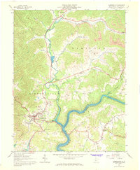
1967 Map of Summersville
USGS Topo · Published 1968About this map
Summersville Lake dominates the central landscape of this 1967 survey, where the Gauley River is constrained by a prominent reservation boundary. The area's industrial character is defined by widespread extraction, with numerous strip mines and gas wells dotting the hills between Hookersville and Canvas. Transportation and commerce are centered on the Baltimore and Ohio railroad corridor as it follows Muddlety Creek, passing through the small community of Muddlety with its rail tipple.
Find a feature on this map
51 named features on this map. Tap any name to fly to it.
Don’t see what you’re looking for? This feature index may not catch every label — zoom into the map to look around manually.
Map Details
Editions of this 1967 Summersville Map
2 editions found
Other maps of this area

1889 · Nicholas
USGS Topo · 1:125,000

1891 · Nicholas
USGS Topo · 1:125,000

1901 · Nicholas
USGS Topo · 1:125,000

1913 · Summersville
USGS Topo · 1:48,000

1914 · Winona
USGS Topo · 1:48,000

1915 · Cowen
USGS Topo · 1:48,000
1915 · Summersville
USGS Topo · 1:62,500

1916 · Winona
USGS Topo · 1:62,500

1917 · Cowen
USGS Topo · 1:62,500

1918 · Richwood
USGS Topo · 1:62,500