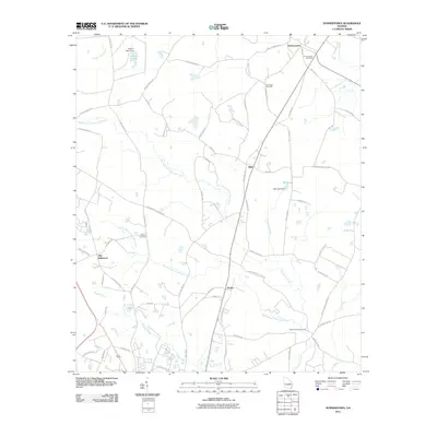
2011 Map of Summertown
USGS Topo · Published 2011About this map
Summertown and the crossroads communities of Blun, Modoc, and Old Dellwood anchor this landscape defined by the branching tributaries of the Canoochee River system. The drainage patterns of North Prong Canoochee Creek and South Prong Canoochee Creek dictate the local geography, feeding into impoundments like Jenkins Pond and Bell Lake. These water sources were critical to early industry and agriculture, evidenced by the Jenkins Pond Dam and Bell Lake Dam structures.
Find a feature on this map
64 named features on this map. Tap any name to fly to it.
Don’t see what you’re looking for? This feature index may not catch every label — zoom into the map to look around manually.
Map Details
Editions of this 2011 Summertown Map
This is the sole edition of this map. No revisions or reprints were ever made.
Other maps of this area

1957 · Macon
USGS Topo · 1:250,000

1958 · Macon
USGS Topo · 1:250,000

1964 · Macon
USGS Topo · 1:250,000

1971 · Norristown
USGS Topo · 1:24,000

1971 · Swainsboro
USGS Topo · 1:24,000

1971 · Dellwood
USGS Topo · 1:24,000

1971 · Twin City
USGS Topo · 1:24,000
1971 · Canoochee
USGS Topo · 1:24,000

1971 · Summertown
USGS Topo · 1:24,000

1973 · Colemans Lake
USGS Topo · 1:24,000