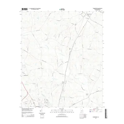
2014 Map of Summertown
USGS Topo · Published 2014About this map
Summertown and the northern outskirts of Swainsboro anchor this Emanuel County landscape, where the headwaters of the Canoochee River system divide the terrain. The hydrological network is the dominant geographic feature, defined by the winding paths of N Prong Canoochee Cr, S Prong Canoochee Cr, and Hughes Prong. These waterways create a low-lying, well-watered environment dotted with landmarks like Jenkins Pond and Bell Lake.
Find a feature on this map
82 named features on this map. Tap any name to fly to it.
Don’t see what you’re looking for? This feature index may not catch every label — zoom into the map to look around manually.
Map Details
Editions of this 2014 Summertown Map
This is the sole edition of this map. No revisions or reprints were ever made.
Other maps of this area

1957 · Macon
USGS Topo · 1:250,000

1958 · Macon
USGS Topo · 1:250,000

1964 · Macon
USGS Topo · 1:250,000

1971 · Norristown
USGS Topo · 1:24,000

1971 · Swainsboro
USGS Topo · 1:24,000

1971 · Dellwood
USGS Topo · 1:24,000

1971 · Twin City
USGS Topo · 1:24,000
1971 · Canoochee
USGS Topo · 1:24,000

1971 · Summertown
USGS Topo · 1:24,000

1973 · Colemans Lake
USGS Topo · 1:24,000