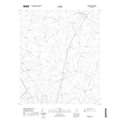
2020 Map of Summertown
USGS Topo · Published 2020About this map
Summertown and its surrounding Emanuel County landscape are defined by the convergence of the northern and southern forks of the Canoochee Cr. The drainage network includes N Prong Canoochee Cr and S Prong Canoochee Cr, which carve through the terrain alongside smaller tributaries like Daniels Mill Cr and Hughes Prong. This area maintains a quiet, rural character marked by small settlements such as Blun, Modoc, and Old Dellwood.
Find a feature on this map
76 named features on this map. Tap any name to fly to it.
Don’t see what you’re looking for? This feature index may not catch every label — zoom into the map to look around manually.
Map Details
Editions of this 2020 Summertown Map
This is the sole edition of this map. No revisions or reprints were ever made.
Other maps of this area

1957 · Macon
USGS Topo · 1:250,000

1958 · Macon
USGS Topo · 1:250,000

1964 · Macon
USGS Topo · 1:250,000

1971 · Norristown
USGS Topo · 1:24,000

1971 · Swainsboro
USGS Topo · 1:24,000

1971 · Dellwood
USGS Topo · 1:24,000

1971 · Twin City
USGS Topo · 1:24,000
1971 · Canoochee
USGS Topo · 1:24,000

1971 · Summertown
USGS Topo · 1:24,000

1973 · Colemans Lake
USGS Topo · 1:24,000