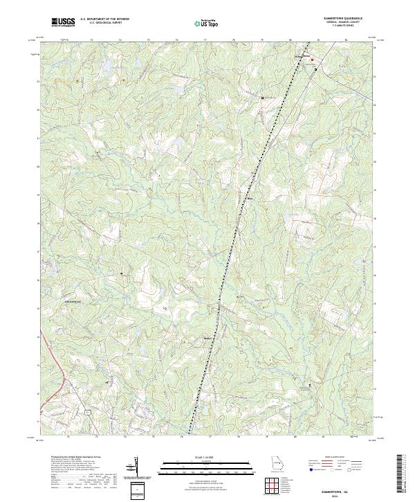
2024 Map of Summertown
USGS Topo · Published 2024About this map
Summertown and the surrounding rural landscape of Emanuel County are defined by the winding paths of the North Prong Canoochee Creek and South Prong Canoochee Creek. In this 2024 survey, the community structure remains centered on crossroads and historical landmarks such as Blun, Modoc, and Old Dellwood. The map reveals a high density of small cemeteries and local congregations that serve as vital links for family researchers, including Hawhammock Church/Cem and the New Hope Cem.
Find a feature on this map
77 named features on this map. Tap any name to fly to it.
Don’t see what you’re looking for? This feature index may not catch every label — zoom into the map to look around manually.
Map Details
Editions of this 2024 Summertown Map
This is the sole edition of this map. No revisions or reprints were ever made.
Other maps of this area

1957 · Macon
USGS Topo · 1:250,000

1958 · Macon
USGS Topo · 1:250,000

1964 · Macon
USGS Topo · 1:250,000

1971 · Norristown
USGS Topo · 1:24,000

1971 · Swainsboro
USGS Topo · 1:24,000

1971 · Dellwood
USGS Topo · 1:24,000

1971 · Twin City
USGS Topo · 1:24,000
1971 · Canoochee
USGS Topo · 1:24,000

1971 · Summertown
USGS Topo · 1:24,000

1973 · Colemans Lake
USGS Topo · 1:24,000