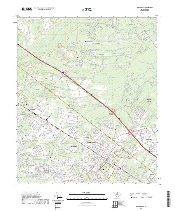
2024 Map of Summerville
USGS Topo · Published 2024About this map
Summerville serves as the focal point of this Lowcountry landscape where the borders of Berkeley, Dorchester, and Charleston counties converge. The modern suburban expansion is clearly visible, with large residential developments like Sangaree and Ladson filling the spaces between established corridors. To the northwest, the character of the land shifts toward more rural patterns near Jedburg and Lotts Crossroads, where the upper reaches of the Ashley River and Dawson Branch wind through a terrain marked by numerous tributaries.
Find a feature on this map
303 named features on this map. Tap any name to fly to it.
Don’t see what you’re looking for? This feature index may not catch every label — zoom into the map to look around manually.
Map Details
Editions of this 2024 Summerville Map
This is the sole edition of this map. No revisions or reprints were ever made.
Other maps of this area

1918 · Cottageville
USGS Topo · 1:62,500

1919 · Ladson
USGS Topo · 1:21,120

1919 · Summerville
USGS Topo · 1:48,000

1919 · Ridgeville
USGS Topo · 1:48,000

1920 · Ravenels
USGS Topo · 1:62,500

1920 · Ridgeville
USGS Topo · 1:62,500

1920 · Summerville
USGS Topo · 1:62,500

1943 · Cottageville
USGS Topo · 1:62,500

1943 · Ladson
USGS Topo · 1:24,000

1943 · Ridgeville
USGS Topo · 1:62,500