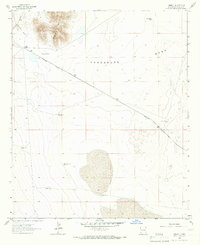
1964 Map of Summit
USGS Topo · Published 1966About this map
The Southern Pacific railroad cuts a sharp diagonal across this arid landscape in the mid-1960s, serving the small settlement of Summit. Located in the bootheel region of New Mexico, the terrain is defined by the broad expanse of Lordsburg Mesa and the prominent rising of the Summit Hills in the northwest. This environment is shaped by the search for water, evidenced by a network of ranching infrastructure and desert watering points.
Find a feature on this map
15 named features on this map. Tap any name to fly to it.
Don’t see what you’re looking for? This feature index may not catch every label — zoom into the map to look around manually.
Map Details
Editions of this 1964 Summit Map
This is the sole edition of this map. No revisions or reprints were ever made.
Other maps of this area

1917 · San Simon
USGS Topo · 1:125,000

1926 · Orange Butte
USGS Topo · 1:62,500

1950 · San Simon
USGS Topo · 1:62,500

1951 · San Simon
USGS Topo · 1:62,500

1954 · Silver City
USGS Topo · 1:250,000

1958 · Silver City
USGS Topo · 1:250,000

1959 · Canador Peak
USGS Topo · 1:62,500

1960 · Duncan
USGS Topo · 1:62,500

1962 · Silver City
USGS Topo · 1:250,000
1962 · San Simon
USGS Topo · 1:62,500