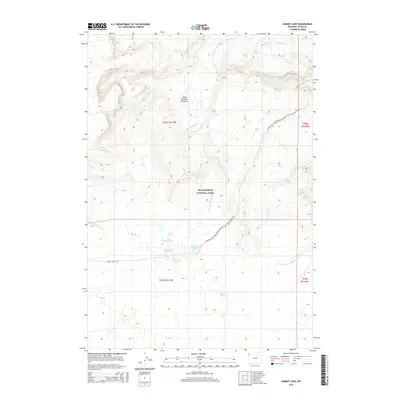
2015 Map of Summit Lake
USGS Topo · Published 2015About this map
The high plateau of Yellowstone National Park reveals a complex hydrothermal landscape in this 2015 survey. Centered on the high-elevation Summit Lake, the map documents the critical intersection of the Continental Divide National Scenic Trail and the local Summit Lake Trail. The geothermal character of the region is evident in the presence of Smoke Jumper Hot Springs and Summit Lake Hot Springs, which feed into the headwaters of the Little Firehole River. This waterway meanders through the expansive Little Firehole Meadows, a terrain feature that marks the gradual transition between high ridges and alpine basins. The drainage patterns are further defined by smaller tributaries such as Fairy Cr and W-Fork Iron Spring Cr, illustrating the hydrology of the Continental Divide where snowmelt and thermal activity sustain the river systems of the American West.
Find a feature on this map
15 named features on this map. Tap any name to fly to it.
Don’t see what you’re looking for? This feature index may not catch every label — zoom into the map to look around manually.
Map Details
Editions of this 2015 Summit Lake Map
This is the sole edition of this map. No revisions or reprints were ever made.
Other maps of this area

1885 · Gallatin
USGS Topo · 1:125,000

1885 · Gallatin
USGS Topo · 1:125,000

1886 · Shoshone
USGS Topo · 1:125,000

1888 · Shoshone
USGS Topo · 1:125,000

1895 · Shoshone
USGS Topo · 1:125,000

1901 · Shoshone
USGS Topo · 1:125,000

1901 · Gallatin
USGS Topo · 1:125,000

1908 · Gallatin
USGS Topo · 1:125,000

1908 · Shoshone
USGS Topo · 1:125,000

1911 · Shoshone
USGS Topo · 1:125,000