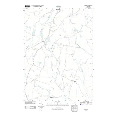
2010 Map of Summit
USGS Topo · Published 2010About this map
Summit sits as a central hub for this portion of the Catskills foothills, where the waters of Summit Lake drain into Wharton Hollow Creek. This 2010 survey details a landscape of narrow valleys and high ridges, notably Burnt Hill and The Cobble, which dictate the winding paths of rural roads like Sawyer Hollow Rd and Rossman Valley Rd. The settlement pattern is deeply connected to its past, evidenced by the numerous paired burial grounds such as the Old Summit Cemetery and New Summit Cemetery, as well as the Old Eminence Cemetery and New Eminence Cemetery near the hamlet of Eminence. To the north, the terrain drops toward Richmondville, while the southern reaches of the map follow the West Kill near East Jefferson. The drainage network, including Charlotte Creek and Betty Brook, highlights the complex topography that has defined Schoharie County farm and forest life for generations.
Find a feature on this map
83 named features on this map. Tap any name to fly to it.
Don’t see what you’re looking for? This feature index may not catch every label — zoom into the map to look around manually.
Map Details
Editions of this 2010 Summit Map
This is the sole edition of this map. No revisions or reprints were ever made.
Other maps of this area

1898 · Schoharie
USGS Topo · 1:62,500

1900 · Schoharie
USGS Topo · 1:62,500

1901 · Gilboa
USGS Topo · 1:62,500

1903 · Gilboa
USGS Topo · 1:62,500

1904 · Richmondville
USGS Topo · 1:62,500

1904 · Hobart
USGS Topo · 1:62,500

1943 · Cobleskill
USGS Topo · 1:24,000

1943 · South Valley
USGS Topo · 1:24,000

1943 · Breakabeen
USGS Topo · 1:24,000

1943 · Charlotteville
USGS Topo · 1:24,000