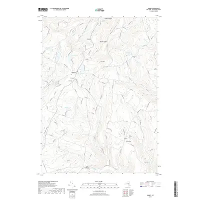
2019 Map of Summit
USGS Topo · Published 2019About this map
Summit sits as the central hub of this Schoharie County terrain, where the northern waters of Summit Lake and Bear Gulch Pond give way to a landscape defined by deep valleys and high ridges. The map documents a rural network of namesake hollows, including Beards Hollow and Charlotte Valley, alongside smaller upland communities like Eminence and East Jefferson. Local history is deeply embedded in the land, marked by numerous small burial grounds such as the Old Summit Cem, the Eminence Walled Cem, and the Rossman Cem. This 2019 survey illustrates a modern road system following ancient natural corridors, where routes like Wharton Hollow Rd and Misty Mountain Rd trace the contours of the Catskill foothills. Notable landmarks like The Cobble and Burnt Hill overlook the winding paths of Wharton Hollow Cr and Panther Cr, showing how the early settlement patterns of these New York uplands have persisted into the current century.
Find a feature on this map
111 named features on this map. Tap any name to fly to it.
Don’t see what you’re looking for? This feature index may not catch every label — zoom into the map to look around manually.
Map Details
Editions of this 2019 Summit Map
This is the sole edition of this map. No revisions or reprints were ever made.
Other maps of this area

1898 · Schoharie
USGS Topo · 1:62,500

1900 · Schoharie
USGS Topo · 1:62,500

1901 · Gilboa
USGS Topo · 1:62,500

1903 · Gilboa
USGS Topo · 1:62,500

1904 · Richmondville
USGS Topo · 1:62,500

1904 · Hobart
USGS Topo · 1:62,500

1943 · Cobleskill
USGS Topo · 1:24,000

1943 · South Valley
USGS Topo · 1:24,000

1943 · Breakabeen
USGS Topo · 1:24,000

1943 · Charlotteville
USGS Topo · 1:24,000