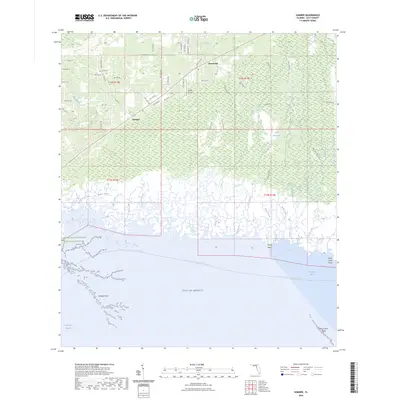
2024 Map of Sumner
USGS Topo · Published 2024About this map
Rosewood and Sumner anchor this coastal landscape where the low-lying Florida woods meet the salt marshes of the Gulf of Mexico. The area is defined by an intricate network of tidal creeks including Porpoise Creek, Jacks Creek, and Kelly Creek, which drain into the shallow waters of Waccasassa Bay. Much of the territory is protected within large conservation areas like the Waccasassa Bay Preserve State Park and the Cedar Key Scrub State Reserve, preserving a shoreline characterized by features like Tripod Point and the Corrigan Reef oyster bars. Inland, the presence of the Shiloh Cemetery and the Cedars Airfield provide evidence of local community life and small-scale aviation amidst the expansive Gulf Hammock. The drainage patterns and road layouts, such as Co Rd 453, reveal a transition from timber and agricultural lands to the ecologically sensitive maritime fringe.
Find a feature on this map
75 named features on this map. Tap any name to fly to it.
Don’t see what you’re looking for? This feature index may not catch every label — zoom into the map to look around manually.
Map Details
Editions of this 2024 Sumner Map
This is the sole edition of this map. No revisions or reprints were ever made.
Other maps of this area

1954 · Otter Creek
USGS Topo · 1:24,000

1954 · Chiefland SW
USGS Topo · 1:24,000

1954 · East Pass
USGS Topo · 1:24,000

1954 · Gainesville
USGS Topo · 1:250,000

1955 · Seahorse Key
USGS Topo · 1:24,000

1955 · Cedar Key
USGS Topo · 1:24,000

1955 · Withlacoochee Bay
USGS Topo · 1:24,000

1955 · Waccasassa Bay
USGS Topo · 1:24,000

1955 · Sumner
USGS Topo · 1:24,000

1958 · Gainesville
USGS Topo · 1:250,000