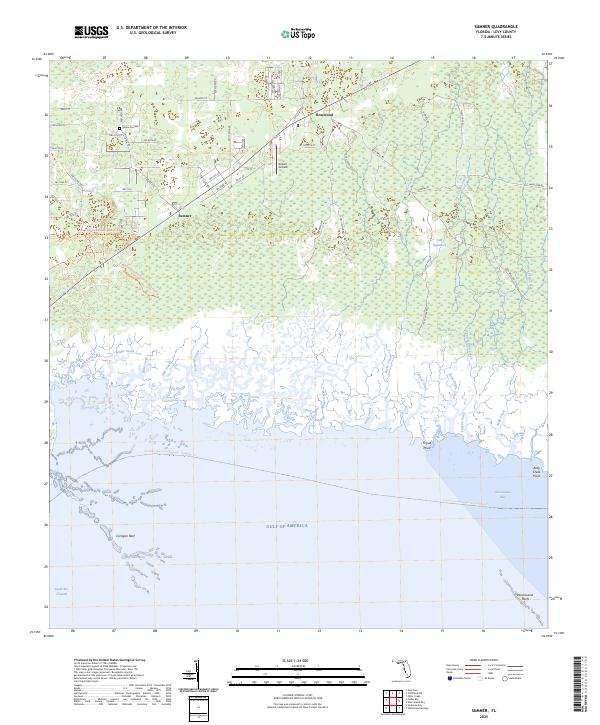
2025 Map of Sumner
USGS Topo · Published 2025About this map
Rosewood and Sumner anchor the northern landscape of this coastal Levy County region, where the pine-dominated flatwoods meet the expansive marshlands of the Gulf of America. The settlement pattern is defined by rural road networks like SW Shiloh Rd, which leads to the historic Shiloh Cem, a vital point of interest for genealogists and local historians. This interior transition zone quickly gives way to the dense vegetation of Gulf Hammock, a significant natural feature that dominates the eastern portion of the survey.
Find a feature on this map
67 named features on this map. Tap any name to fly to it.
Don’t see what you’re looking for? This feature index may not catch every label — zoom into the map to look around manually.
Map Details
Editions of this 2025 Sumner Map
This is the sole edition of this map. No revisions or reprints were ever made.
Other maps of this area

1954 · Otter Creek
USGS Topo · 1:24,000

1954 · Chiefland SW
USGS Topo · 1:24,000

1954 · East Pass
USGS Topo · 1:24,000

1954 · Gainesville
USGS Topo · 1:250,000

1955 · Seahorse Key
USGS Topo · 1:24,000

1955 · Cedar Key
USGS Topo · 1:24,000

1955 · Withlacoochee Bay
USGS Topo · 1:24,000

1955 · Waccasassa Bay
USGS Topo · 1:24,000

1955 · Sumner
USGS Topo · 1:24,000

1958 · Gainesville
USGS Topo · 1:250,000