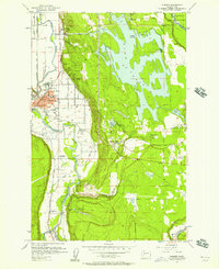
1956 Map of Sumner
USGS Topo · Published 1957About this map
The Puyallup River and Stuck River valleys define this mid-1950s landscape, where rail transport and industrial infrastructure converge near the Pierce-King county line. The Northern Pacific, Great Northern, and Chicago Milwaukee St Paul and Pacific railroads intersect at Sumner, which serves as the regional hub with its City Hall and High School. Outside the town center, the Riverside Infirmary and the White River Power Plant near Dieringer represent the era's institutional and industrial development.
Find a feature on this map
46 named features on this map. Tap any name to fly to it.
Don’t see what you’re looking for? This feature index may not catch every label — zoom into the map to look around manually.
Map Details
Editions of this 1956 Sumner Map
4 editions found
Other maps of this area

1897 · Tacoma
USGS Topo · 1:125,000

1900 · Tacoma
USGS Topo · 1:125,000

1941 · Tacoma South
USGS Topo · 1:62,500

1942 · Lake Tapps
USGS Topo · 1:62,500

1944 · Lake Tapps
USGS Topo · 1:62,500

1944 · Tacoma South
USGS Topo · 1:62,500

1949 · Black Diamond
USGS Topo · 1:24,000

1949 · Poverty Bay
USGS Topo · 1:24,000

1949 · Auburn
USGS Topo · 1:24,000

1956 · Orting
USGS Topo · 1:24,000