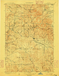
1901 Map of Sumpter
USGS Topo · Published 1910About this map
Sumpter serves as the industrial and transportation hub for this portion of the Blue Mountains at the turn of the century, anchored by the Sumpter Valley Railroad. This 1901 survey documents the peak of the gold mining era in eastern Oregon, showing a landscape defined by extractive industry and the temporary settlements that supported it. Notable mining centers like Columbia Golconda, Baisley-Elkhorn, and Redboy are situated among the high peaks of Elkhorn Ridge. The map reveals the intricate infrastructure of the day, from the Auburn Ditch waterway to the numerous gulches and flats like French Diggings and Congo Gulch that were actively being worked. Scattered towns such as Bourne, Granite, and Austin provide a glimpse into the distribution of the population within the Whitman National Forest before many of these mountain camps were absorbed into larger municipal centers or became footnotes in regional history.
Find a feature on this map
100 named features on this map. Tap any name to fly to it.
Don’t see what you’re looking for? This feature index may not catch every label — zoom into the map to look around manually.
Map Details
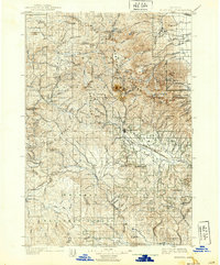
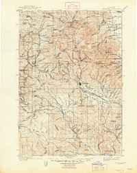
Editions of this 1901 Sumpter Map
4 editions found
Other maps of this area

1901 · Baker City
USGS Topo · 1:125,000

1901 · Sumpter
USGS Topo · 1:125,000

1906 · Telocaset
USGS Topo · 1:125,000

1908 · Ironside Mountain
USGS Topo · 1:125,000

1951 · Bates
USGS Topo · 1:62,500

1951 · Desolation Butte
USGS Topo · 1:62,500

1953 · Pendleton
USGS Topo · 1:250,000

1955 · Baker
USGS Topo · 1:250,000

1955 · Grangeville
USGS Topo · 1:250,000

1955 · Canyon City
USGS Topo · 1:250,000