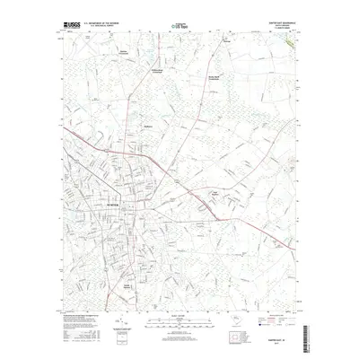
2017 Map of Sumter East
USGS Topo · Published 2017About this map
The city of Sumter and its surrounding crossroads are detailed in this 2017 survey, illustrating a landscape defined by significant wetlands and family-named landmarks. To the north and east, the expansive Rocky Bluff Swamp and Whites Millpond dominate the low-lying terrain, while the residential and commercial growth of East Sumter and South Sumter radiates from the historic core. The map is a valuable resource for genealogical research, documenting numerous burial sites such as Webb Cem, Brogden Cem, and Clark Cem.
Find a feature on this map
296 named features on this map. Tap any name to fly to it.
Don’t see what you’re looking for? This feature index may not catch every label — zoom into the map to look around manually.
Map Details
Editions of this 2017 Sumter East Map
This is the sole edition of this map. No revisions or reprints were ever made.
Other maps of this area

1920 · Mayesville
USGS Topo · 1:48,000

1921 · Mayesville
USGS Topo · 1:62,500

1941 · Spartanburg
USGS Topo · 1:250,000

1943 · Mayesville
USGS Topo · 1:62,500

1946 · Sumter
USGS Topo · 1:62,500

1953 · Spartanburg
USGS Topo · 1:250,000

1954 · Augusta
USGS Topo · 1:250,000

1957 · Sumter East
USGS Topo · 1:24,000

1957 · Sumter West
USGS Topo · 1:24,000

1957 · Ashwood
USGS Topo · 1:62,500