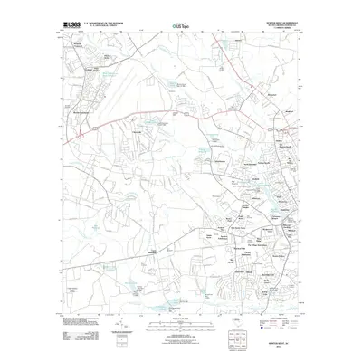
2011 Map of Sumter West
USGS Topo · Published 2011About this map
Green Swamp and Mush Swamp branch through this landscape just west of the city, where mid-century residential expansion meets older agricultural patterns. The area is defined by numerous water impoundments, including Loring Millpond, New Millpond, and Booths Pond, reflecting a legacy of water management for local industry and recreation. Small communities like Cherryvale and Shaw Heights are established alongside recreational hubs such as Gamecock Raceway and the Cane Savannah Raceway. Genealogists will find a high density of family and community burial sites, including Four Bridges Cemetery, Pitts Cemetery, and Saint Lukes Cemetery. The presence of the Creech Aviation Facility Airport and numerous named subdivisions like Oak Haven Acres and Sellars Heights illustrates the suburbanization of this South Carolina corridor during the late 20th century.
Find a feature on this map
220 named features on this map. Tap any name to fly to it.
Don’t see what you’re looking for? This feature index may not catch every label — zoom into the map to look around manually.
Map Details
Editions of this 2011 Sumter West Map
This is the sole edition of this map. No revisions or reprints were ever made.
Other maps of this area

1938 · Hagood
USGS Topo · 1:62,500

1941 · Spartanburg
USGS Topo · 1:250,000

1942 · Camden
USGS Topo · 1:125,000

1943 · Eastover
USGS Topo · 1:62,500

1946 · Sumter
USGS Topo · 1:62,500

1953 · Poinsett State Park
USGS Topo · 1:24,000

1953 · Wedgefield
USGS Topo · 1:24,000

1953 · Rembert
USGS Topo · 1:24,000

1953 · Spartanburg
USGS Topo · 1:250,000

1954 · Augusta
USGS Topo · 1:250,000