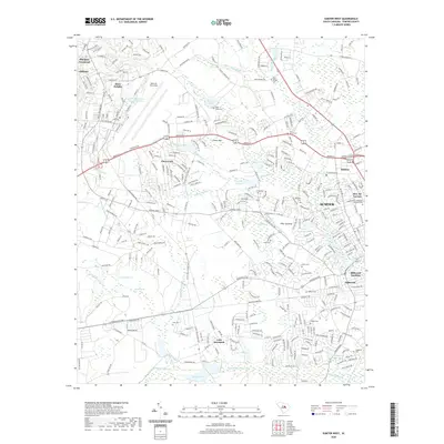
2020 Map of Sumter West
USGS Topo · Published 2020About this map
Shaw Air Force Base dominates the northern landscape of this South Carolina study, providing a clear view of its expansive airfield and infrastructure adjacent to Shaw Heights. Moving south and east, the terrain transitions into the suburban and residential outskirts of Sumter, where neighborhoods like Bon Air Terrace and Millwood Gardens meet established sites like Evergreen Memorial Park. The map documents a complex hydrography defined by the Mush Swamp and the Green Swamp, as well as numerous man-made and natural water bodies such as Loring Millpond and Upper Deerwood Lake. Rural genealogy is well-supported by the inclusion of family-named burial grounds and small community landmarks, from Miller Cem to the Saint Johns Cem. This survey illustrates the modern road network, including the Patriot Pkwy and Wedgefield Rd, as they navigate the wetlands and savannas that characterize this portion of Sumter County.
Find a feature on this map
51 named features on this map. Tap any name to fly to it.
Don’t see what you’re looking for? This feature index may not catch every label — zoom into the map to look around manually.
Map Details
Editions of this 2020 Sumter West Map
This is the sole edition of this map. No revisions or reprints were ever made.
Other maps of this area

1938 · Hagood
USGS Topo · 1:62,500

1941 · Spartanburg
USGS Topo · 1:250,000

1942 · Camden
USGS Topo · 1:125,000

1943 · Eastover
USGS Topo · 1:62,500

1946 · Sumter
USGS Topo · 1:62,500

1953 · Poinsett State Park
USGS Topo · 1:24,000

1953 · Wedgefield
USGS Topo · 1:24,000

1953 · Rembert
USGS Topo · 1:24,000

1953 · Spartanburg
USGS Topo · 1:250,000

1954 · Augusta
USGS Topo · 1:250,000