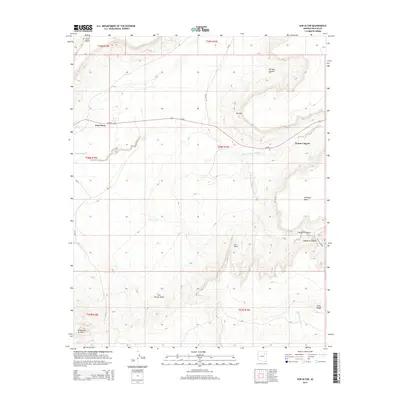
2014 Map of Sun Altar
USGS Topo · Published 2014About this map
Keams Canyon and the surrounding mesa country of the Navajo Nation are documented in this detailed 2014 study. The landscape is defined by its dramatic geological features, from the elevation of First Mesa in the northwest to the notable formation at Sun Altar. The settlement pattern follows the drainage of Keams Canyon Wash and Polacca Wash, with Az-264 serving as the primary corridor across the high plateau.
Find a feature on this map
28 named features on this map. Tap any name to fly to it.
Don’t see what you’re looking for? This feature index may not catch every label — zoom into the map to look around manually.
Map Details
Editions of this 2014 Sun Altar Map
This is the sole edition of this map. No revisions or reprints were ever made.
Other maps of this area

1883 · Tusayan
USGS Topo · 1:250,000

1886 · Tusayan
USGS Topo · 1:250,000

1947 · Flagstaff
USGS Topo · 1:250,000

1954 · Flagstaff
USGS Topo · 1:250,000

1958 · Flagstaff
USGS Topo · 1:250,000

1960 · Flagstaff
USGS Topo · 1:250,000

1962 · Flagstaff
USGS Topo · 1:250,000

1966 · White Cone
USGS Topo · 1:62,500

1966 · Egloffstein Butte
USGS Topo · 1:62,500
1966 · Keams Canyon
USGS Topo · 1:62,500