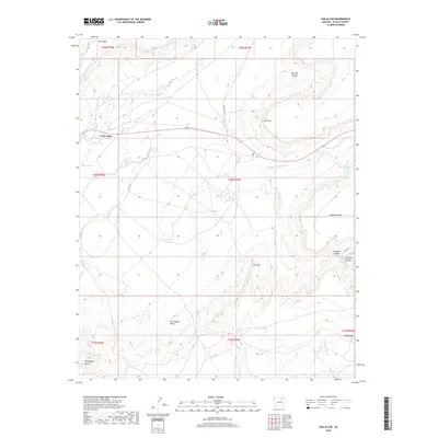
2018 Map of Sun Altar
USGS Topo · Published 2018About this map
First Mesa dominates the northwestern portion of this Navajo County landscape, where the high plateau topography drops sharply into the drainage systems of Polacca Wash and Keams Canyon Wash. The land is characterized by dramatic landforms such as Mots'ovi and the elevated expanse of Antelope Mesa to the east. Modern travel follows the corridor of Highway 264, which bisects the quadrangle as it moves across the high desert between mesas.
Find a feature on this map
28 named features on this map. Tap any name to fly to it.
Don’t see what you’re looking for? This feature index may not catch every label — zoom into the map to look around manually.
Map Details
Editions of this 2018 Sun Altar Map
This is the sole edition of this map. No revisions or reprints were ever made.
Other maps of this area

1883 · Tusayan
USGS Topo · 1:250,000

1886 · Tusayan
USGS Topo · 1:250,000

1947 · Flagstaff
USGS Topo · 1:250,000

1954 · Flagstaff
USGS Topo · 1:250,000

1958 · Flagstaff
USGS Topo · 1:250,000

1960 · Flagstaff
USGS Topo · 1:250,000

1962 · Flagstaff
USGS Topo · 1:250,000

1966 · White Cone
USGS Topo · 1:62,500

1966 · Egloffstein Butte
USGS Topo · 1:62,500
1966 · Keams Canyon
USGS Topo · 1:62,500