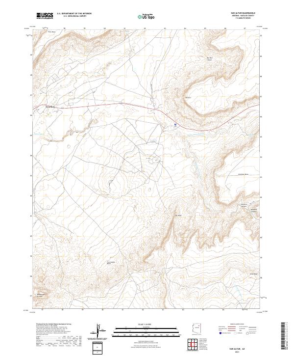
2021 Map of Sun Altar
USGS Topo · Published 2021About this map
First Mesa dominates the western edge of this High Plateau landscape, where traditional settlement patterns follow the high ground and drainages of Navajo County. The terrain is defined by a series of prominent mesas and buttes, including the namesake Sun Altar and Five Houses Butte, which rise above the surrounding desert floor. This 2021 survey illustrates a region where water management and natural hydrology are central to life, evidenced by a network of seasonal washes like Polacca Wash and Keams Canyon Wash. The presence of Sactone Spring on the slopes of Antelope Mesa highlights the critical importance of isolated water sources in this arid environment. Transportation through the area relies on established routes such as Indian Rte 60 and BIA 16 Rd, which negotiate the complex topography of canyons and ridges like Gray Ridge.
Find a feature on this map
27 named features on this map. Tap any name to fly to it.
Don’t see what you’re looking for? This feature index may not catch every label — zoom into the map to look around manually.
Map Details
Editions of this 2021 Sun Altar Map
This is the sole edition of this map. No revisions or reprints were ever made.
Other maps of this area

1883 · Tusayan
USGS Topo · 1:250,000

1886 · Tusayan
USGS Topo · 1:250,000

1947 · Flagstaff
USGS Topo · 1:250,000

1954 · Flagstaff
USGS Topo · 1:250,000

1958 · Flagstaff
USGS Topo · 1:250,000

1960 · Flagstaff
USGS Topo · 1:250,000

1962 · Flagstaff
USGS Topo · 1:250,000

1966 · White Cone
USGS Topo · 1:62,500

1966 · Egloffstein Butte
USGS Topo · 1:62,500
1966 · Keams Canyon
USGS Topo · 1:62,500