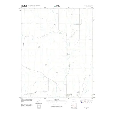
2009 Map of Sun City
USGS Topo · Published 2009About this map
The Medicine Lodge River meanders across this Barber County landscape, defining the character of the region south of the Elm Mills area. The small settlement of Sun City serves as the focal point, situated near the river and the quiet grounds of Sunnyside Cemetery. The terrain is marked by a complex network of resource extraction, with the Sun City Oil Field, Moffett West Oil Field, and Turkey Creek East Gas Field distributed throughout the rolling countryside. This 2009 survey highlights a rural economy where petroleum interests coexist with agricultural land. Local infrastructure is anchored by primary routes like Sun City Rd and River Rd, which connect isolated homesteads and the Turkey Creek Camp to the larger creek systems of Turkey Creek and Mulberry Creek. To the north, Chinn Cemetery stands as another quiet landmark of early settlement history in this sparsely populated stretch of Kansas.
Find a feature on this map
22 named features on this map. Tap any name to fly to it.
Don’t see what you’re looking for? This feature index may not catch every label — zoom into the map to look around manually.
Map Details
Editions of this 2009 Sun City Map
This is the sole edition of this map. No revisions or reprints were ever made.
Other maps of this area

1889 · Kinsley
USGS Topo · 1:125,000

1891 · Medicine Lodge
USGS Topo · 1:125,000

1892 · Kinsley
USGS Topo · 1:125,000

1892 · Coldwater
USGS Topo · 1:125,000

1892 · Pratt
USGS Topo · 1:125,000

1893 · Medicine Lodge
USGS Topo · 1:125,000

1894 · Kinsley
USGS Topo · 1:125,000

1894 · Pratt
USGS Topo · 1:125,000

1955 · Pratt
USGS Topo · 1:250,000

1959 · Pratt
USGS Topo · 1:250,000