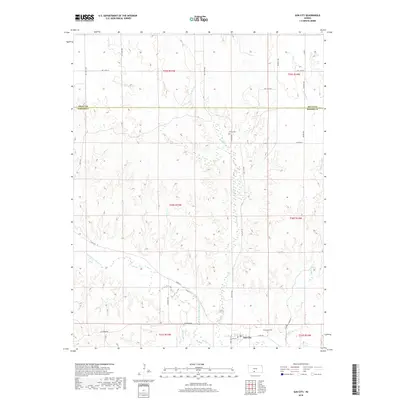
2018 Map of Sun City
USGS Topo · Published 2018About this map
Sun City sits at the southern edge of this landscape where the Medicine Lodge River curves through the prairie terrain. The settlement is defined by its small grid of streets including Elm St and S 3rd Ave W, serving as a central point for the surrounding rural sections of Barber County. The drainage patterns of Turkey Cr and Mulberry Cr dictate the local geography, with secondary roads like Sun City Rd and River Rd following the natural contours of the river valley. For genealogists, the map identifies local burial sites such as Sunnyside Cem just east of the main town site and Chinn Cem located further north along the banks of Turkey Creek. Evidence of earlier rural centers or landmarks can be found at Elm Mills, reflecting the historical reliance on water power and local transport routes in this part of Kansas.
Find a feature on this map
31 named features on this map. Tap any name to fly to it.
Don’t see what you’re looking for? This feature index may not catch every label — zoom into the map to look around manually.
Map Details
Editions of this 2018 Sun City Map
This is the sole edition of this map. No revisions or reprints were ever made.
Other maps of this area

1889 · Kinsley
USGS Topo · 1:125,000

1891 · Medicine Lodge
USGS Topo · 1:125,000

1892 · Kinsley
USGS Topo · 1:125,000

1892 · Coldwater
USGS Topo · 1:125,000

1892 · Pratt
USGS Topo · 1:125,000

1893 · Medicine Lodge
USGS Topo · 1:125,000

1894 · Kinsley
USGS Topo · 1:125,000

1894 · Pratt
USGS Topo · 1:125,000

1955 · Pratt
USGS Topo · 1:250,000

1959 · Pratt
USGS Topo · 1:250,000