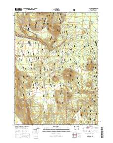
2014 Map of Sun Pass
USGS Topo · Published 2014About this map
Winema National Forest dominates this section of Klamath County, bordering the eastern edge of Crater Lake National Park. The landscape is defined by distinct volcanic and glacial features, notably the volcanic prominence of Sun Mtn and the elevations of Dry Butte and Boundary Butte. These peaks rise above a network of forest service roads that trace the terrain, reflecting the management and access patterns of the United States Forest Service during the early 21st century. Water sources like Sand Cr and the localized Egan Springs provide the primary hydrological points of interest in this high-elevation forest environment. The map details the transition from the protected park wilderness to the managed forest lands, where Sun Mountain Rd and Sand Creek Rd provide the main corridors through the timber and volcanic ridges.
Find a feature on this map
21 named features on this map. Tap any name to fly to it.
Don’t see what you’re looking for? This feature index may not catch every label — zoom into the map to look around manually.
Map Details
Editions of this 2014 Sun Pass Map
This is the sole edition of this map. No revisions or reprints were ever made.
Other maps of this area

1889 · Klamath
USGS Topo · 1:250,000

1891 · Ashland
USGS Topo · 1:250,000

1893 · Ashland
USGS Topo · 1:250,000

1894 · Klamath
USGS Topo · 1:250,000

1897 · Ashland
USGS Topo · 1:250,000

1955 · Pelican Butte
USGS Topo · 1:62,500

1955 · Klamath Falls
USGS Topo · 1:250,000

1955 · Medford
USGS Topo · 1:250,000

1957 · Medford
USGS Topo · 1:250,000

1957 · Chiloquin
USGS Topo · 1:62,500