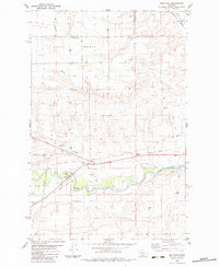
1983 Map of Sun River
USGS Topo · Published 1983About this map
The Sun River meanders through a landscape defined by significant irrigation infrastructure and historic transportation routes in central Montana. The valley floor is flanked by prominent geological features like Ashuelot Bench and First Bench, while human engineering is evident in the Sun River Valley Ditch and the Greenfields South Canal. The settlement of Sun River serves as a local hub, supported by the Sun River Valley Ch and connected to outlying points like Dracut and Dracut Junction.
Find a feature on this map
26 named features on this map. Tap any name to fly to it.
Don’t see what you’re looking for? This feature index may not catch every label — zoom into the map to look around manually.
Map Details
Editions of this 1983 Sun River Map
This is the sole edition of this map. No revisions or reprints were ever made.
Other maps of this area

1886 · Great Falls
USGS Topo · 1:250,000

1949 · Cascade
USGS Topo · 1:62,500

1949 · Vaughn
USGS Topo · 1:62,500

1950 · Fairfield
USGS Topo · 1:62,500

1951 · Cascade
USGS Topo · 1:62,500

1952 · Vaughn
USGS Topo · 1:62,500

1954 · Great Falls
USGS Topo · 1:250,000

1957 · Great Falls
USGS Topo · 1:250,000

1960 · Simms
USGS Topo · 1:62,500

1976 · Great Falls North
USGS Topo · 1:100,000