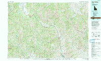
1992 Map of Sun Valley
USGS Topo · Published 1993About this map
Sun Valley and Ketchum anchor the central valley of this 1990s-era topographic survey, which highlights the intersection of Idaho's resort developments and its industrial history. The Big Wood River provides the primary drainage through the Wood River Valley, where the mountain-bound settlements of Hailey and Triumph are situated. High-elevation peaks, including Hyndman Peak and Castle Peak, define the skyline across the Sawtooth Mountains, Boulder Mountains, and Pioneer Mountains. This map captures the region's complexity, showing the Sawtooth National Recreation Area alongside significant mineral extraction sites like the Triumph Mine and Phi Kappa Mine. Large alpine water bodies, such as Redfish Lake, Alturas Lake, and Pettit Lake, mark the northern reaches of the quadrangle, serving as focal points for the extensive protected lands of the Challis National Forest and Sawtooth National Forest.
Find a feature on this map
29 named features on this map. Tap any name to fly to it.
Don’t see what you’re looking for? This feature index may not catch every label — zoom into the map to look around manually.
Map Details
Editions of this 1992 Sun Valley Map
2 editions found
Other maps of this area

1891 · Bear Valley
USGS Topo · 1:125,000

1892 · Camas Prairie
USGS Topo · 1:125,000

1893 · Bear Valley
USGS Topo · 1:125,000

1893 · Camas Prairie
USGS Topo · 1:125,000

1894 · Rocky Bar
USGS Topo · 1:125,000

1895 · Hailey
USGS Topo · 1:125,000

1897 · Hailey
USGS Topo · 1:125,000

1900 · Sawtooth
USGS Topo · 1:125,000

1919 · Custer
USGS Topo · 1:125,000

1922 · Custer
USGS Topo · 1:125,000