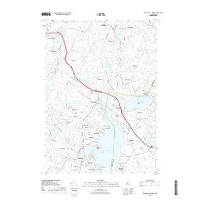
2018 Map of Sunapee Lake North
USGS Topo · Published 2018About this map
Sunapee Lake dominates the southern half of this landscape, its northern reaches defined by complex inlets like Herrick Cove and the protected waters of Sunapee Harbor. The surrounding terrain is a network of smaller glacial basins and prominent elevations including Hoyt Hill and Pitcher Hill. Evidence of earlier resource extraction persists at Mica Mine Hill, while established settlements such as Georges Mills, Lakeside, and Otterville anchor the shoreline and valley floors.
Find a feature on this map
165 named features on this map. Tap any name to fly to it.
Don’t see what you’re looking for? This feature index may not catch every label — zoom into the map to look around manually.
Map Details
Editions of this 2018 Sunapee Lake North Map
This is the sole edition of this map. No revisions or reprints were ever made.
Other maps of this area

1902 · Sunapee
USGS Topo · 1:62,500

1905 · Sunapee
USGS Topo · 1:62,500

1907 · Sunapee
USGS Topo · 1:62,500

1927 · Cardigan
USGS Topo · 1:62,500

1927 · Mascoma
USGS Topo · 1:62,500

1928 · Mount Kearsarge
USGS Topo · 1:62,500

1930 · Cardigan
USGS Topo · 1:62,500

1931 · Mount Kearsarge
USGS Topo · 1:62,500

1932 · Mascoma
USGS Topo · 1:62,500

1949 · Portland
USGS Topo · 1:250,000