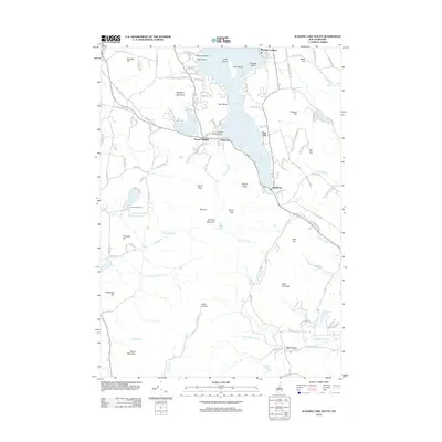
2012 Map of Sunapee Lake South
USGS Topo · Published 2012About this map
Lake Sunapee defines the northern reaches of this landscape, its shoreline dotted with residential clusters and seasonal landmarks like Blodgett Landing and State Park Beach. The terrain rises sharply to the south toward Sunapee Mountain, where several prominent summits including North Peak, South Peak, and the Summit overlook the high-altitude Lake Solitude. This area represents a well-developed recreational corridor in the early 21st century, anchored by the settlement of Mount Sunapee and the village of Newbury at the southern tip of the lake.
Find a feature on this map
115 named features on this map. Tap any name to fly to it.
Don’t see what you’re looking for? This feature index may not catch every label — zoom into the map to look around manually.
Map Details
Editions of this 2012 Sunapee Lake South Map
This is the sole edition of this map. No revisions or reprints were ever made.
Other maps of this area

1902 · Sunapee
USGS Topo · 1:62,500

1905 · Sunapee
USGS Topo · 1:62,500

1907 · Sunapee
USGS Topo · 1:62,500

1926 · Hillsboro
USGS Topo · 1:62,500

1928 · Mount Kearsarge
USGS Topo · 1:62,500

1929 · Hillsboro
USGS Topo · 1:62,500

1930 · Lovewell Mountain
USGS Topo · 1:62,500

1931 · Mount Kearsarge
USGS Topo · 1:62,500

1942 · Lovewell Mountain
USGS Topo · 1:62,500

1949 · Portland
USGS Topo · 1:250,000