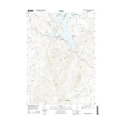
2015 Map of Sunapee Lake South
USGS Topo · Published 2015About this map
Sunapee Lake dominates the northern landscape of this region, its waters dotted with landmarks like Star Island and Emerald Island near Blodgett Landing. The terrain rises sharply to the south, culminating in the prominent ridge of Sunapee Mtn and Mount Sunapee. High on these slopes, the isolated Lake Solitude provides a unique hydrological feature above the Andrew Brook drainage.
Find a feature on this map
117 named features on this map. Tap any name to fly to it.
Don’t see what you’re looking for? This feature index may not catch every label — zoom into the map to look around manually.
Map Details
Editions of this 2015 Sunapee Lake South Map
This is the sole edition of this map. No revisions or reprints were ever made.
Other maps of this area

1902 · Sunapee
USGS Topo · 1:62,500

1905 · Sunapee
USGS Topo · 1:62,500

1907 · Sunapee
USGS Topo · 1:62,500

1926 · Hillsboro
USGS Topo · 1:62,500

1928 · Mount Kearsarge
USGS Topo · 1:62,500

1929 · Hillsboro
USGS Topo · 1:62,500

1930 · Lovewell Mountain
USGS Topo · 1:62,500

1931 · Mount Kearsarge
USGS Topo · 1:62,500

1942 · Lovewell Mountain
USGS Topo · 1:62,500

1949 · Portland
USGS Topo · 1:250,000