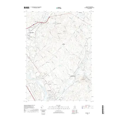
2018 Map of Suncook
USGS Topo · Published 2018About this map
Suncook and the eastern edge of Concord anchor this Merrimack County landscape, defined by the winding course of the Suncook River as it approaches its confluence with the Merrimack River. The geography is a complex network of brooks and ridges, including Plausawa Hill and Pembroke Hill, where the rural character of central New Hampshire is preserved in settlements like North Pembroke and Horse Corner. A high density of local burial grounds, such as the Pembroke Street Cem and Evergreen Cem, provides significant value for genealogical research, documenting the long-standing family lines of the region.
Find a feature on this map
63 named features on this map. Tap any name to fly to it.
Don’t see what you’re looking for? This feature index may not catch every label — zoom into the map to look around manually.
Map Details
Editions of this 2018 Suncook Map
This is the sole edition of this map. No revisions or reprints were ever made.
Other maps of this area

1919 · Gilmanton
USGS Topo · 1:62,500

1921 · Suncook
USGS Topo · 1:62,500

1927 · Concord
USGS Topo · 1:62,500

1927 · Penacook
USGS Topo · 1:62,500

1927 · Gilmanton
USGS Topo · 1:62,500

1944 · Suncook
USGS Topo · 1:62,500

1949 · Portland
USGS Topo · 1:250,000

1949 · Concord
USGS Topo · 1:62,500

1956 · Penacook
USGS Topo · 1:62,500

1956 · Portland
USGS Topo · 1:250,000