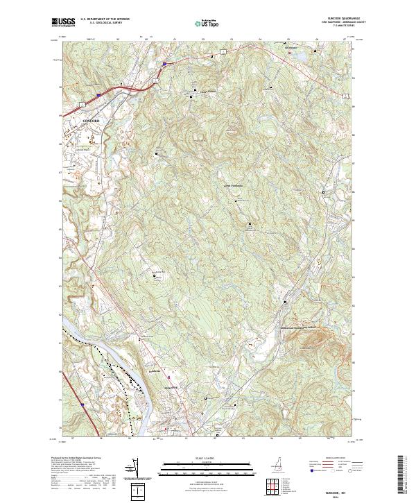
2024 Map of Suncook
USGS Topo · Published 2024About this map
The Merrimack River and Suncook River converge in this region of New Hampshire, shaping a landscape defined by historic riverfront settlements and upland hills. The village of Suncook stands as a primary hub, while the surrounding town of Pembroke extends northward through Pembroke Hill to North Pembroke. The abundance of small family and community burial grounds, such as the Dearborn French Cem, Langley Watson Cem, and Edmunds Stanyan Cem, offers a detailed map for genealogical research throughout the Merrimack valley.
Find a feature on this map
133 named features on this map. Tap any name to fly to it.
Don’t see what you’re looking for? This feature index may not catch every label — zoom into the map to look around manually.
Map Details
Editions of this 2024 Suncook Map
This is the sole edition of this map. No revisions or reprints were ever made.
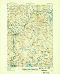
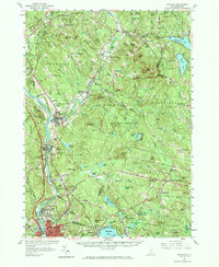
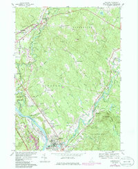
Historical Maps of Emerson Mill Through Time
5 maps found