
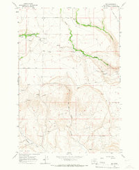
2011 Map of Sundale NW
USGS Topo · Published 2011About this map
The Columbia River serves as the central artery for this region, defining the border between Washington and Oregon. On the northern bank, the landscape is shaped by the Goodnoe Hills and a series of drainage systems including Rock Creek and the marshy Paterson Slough. Small settlements like Quinook and Bates sit along the river's edge, while the upland area known as The Burn dominates the northeastern corner.
Find a feature on this map
22 named features on this map. Tap any name to fly to it.
Don’t see what you’re looking for? This feature index may not catch every label — zoom into the map to look around manually.
Map Details
Editions of this 2011 Sundale NW Map
This is the sole edition of this map. No revisions or reprints were ever made.
Other maps of this area

1916 · Arlington
USGS Topo · 1:125,000

1953 · The Dalles
USGS Topo · 1:250,000

1956 · The Dalles
USGS Topo · 1:250,000

1957 · The Dalles
USGS Topo · 1:250,000

1957 · Wasco
USGS Topo · 1:62,500

1957 · Satus Pass
USGS Topo · 1:62,500

1964 · Turner Butte
USGS Topo · 1:24,000

1964 · Mc Donald
USGS Topo · 1:24,000

1965 · Goodnoe Hills
USGS Topo · 1:24,000
1965 · Dot
USGS Topo · 1:24,000