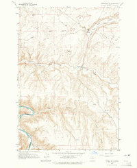
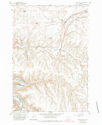
1964 Map of Turner Butte
USGS Topo · Published 1965About this map
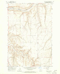
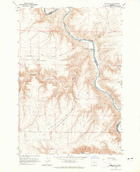
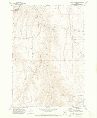
The Oregon Trail (Approximate Route) cuts across the northern landscape of this mid-1960s survey, marking a corridor of westward migration through the high desert of the Pacific Northwest. This region, defined by the winding course of the John Day River and the steep walls of Scott Canyon, shows a landscape dominated by basalt buttes and wide plateaus like Shutler Flat. The infrastructure of the era is represented by the Union Pacific railroad line, which snakes through Alkali Canyon and Rock Creek, supporting the small settlement of Barnett. The map identifies several distinct high points including Butcher Butte, Turner Butte, and Diamond Butte, providing a detailed look at the topographic relief of the Columbia Plateau. Local history markers such as an isolated Grave and various storage bins and water tanks reflect the sparse, ranching-oriented land use at the Sherman Co Gilliam Co boundary.
Find a feature on this map
24 named features on this map. Tap any name to fly to it.
Don’t see what you’re looking for? This feature index may not catch every label — zoom into the map to look around manually.
Map Details
Editions of this 1964 Turner Butte Map
2 editions found
Other maps of this area

1916 · Arlington
USGS Topo · 1:125,000

1916 · Condon
USGS Topo · 1:125,000

1953 · The Dalles
USGS Topo · 1:250,000

1956 · The Dalles
USGS Topo · 1:250,000

1957 · The Dalles
USGS Topo · 1:250,000
1964 · Shutler Flat
USGS Topo · 1:24,000
1964 · Mc Donald
USGS Topo · 1:24,000
1970 · Devils Backbone
USGS Topo · 1:24,000
1970 · Mikkalo
USGS Topo · 1:24,000
1970 · Esau Canyon
USGS Topo · 1:24,000