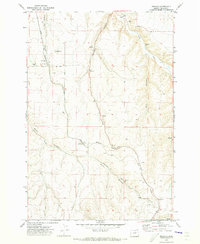
1970 Map of Mikkalo
USGS Topo · Published 1973About this map
Mikkalo sits as a primary rail point along the Union Pacific line in this 1970 survey of Gilliam County. The landscape is defined by the deep incisions of Juniper Canyon and French Charlie Canyon, where the rugged plateau drops away toward the water of Rock Creek. The regional economy of the early 1970s is etched into the map through industrial and agricultural markers, including the Grain Elevator at Mikkalo and several Grain Elevators near Clem. Small settlements like Olex and Speece are connected by a network of unimproved roads and specialized infrastructure like the Reed Landing Strip. Genealogists will find the locations of the Olex Cem and Clem Cem particularly useful for identifying family sites in this sparsely populated portion of the Oregon high country.
Find a feature on this map
24 named features on this map. Tap any name to fly to it.
Don’t see what you’re looking for? This feature index may not catch every label — zoom into the map to look around manually.
Map Details
Editions of this 1970 Mikkalo Map
This is the sole edition of this map. No revisions or reprints were ever made.
Other maps of this area

1916 · Arlington
USGS Topo · 1:125,000

1916 · Condon
USGS Topo · 1:125,000

1953 · The Dalles
USGS Topo · 1:250,000

1956 · The Dalles
USGS Topo · 1:250,000

1957 · The Dalles
USGS Topo · 1:250,000

1964 · Turner Butte
USGS Topo · 1:24,000

1964 · Shutler Flat
USGS Topo · 1:24,000

1964 · Hickland Butte
USGS Topo · 1:24,000

1970 · Devils Backbone
USGS Topo · 1:24,000
1970 · Wolf Hollow Falls
USGS Topo · 1:24,000