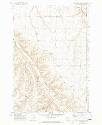
1970 Map of Wolf Hollow Falls
USGS Topo · Published 1973About this map
The Earl Snell Birthplace Historical Monument serves as a focal point in this remote section of Oregon, marking the origin of a former governor amidst a landscape of deep canyons and seasonal watercourses. The topography is dominated by the steep drainage of Rock Creek and Eightmile Canyon, where the rugged elevation changes are captured in sharp detail. Local agricultural infrastructure is evident through several scattered Grain Elevator sites and Storage Bin locations, indicating the area's dryland farming roots. Transportation in the early 1970s relied on a network of unpaved paths, including Bunker Hill Road and various unnamed tracks labeled as Jeep trails. Hidden within the namesake drainage, Wolf Hollow Falls and nearby Waterfalls highlight the natural hydrology that has carved the canyon floors over time, alongside a small Cem that provides a point of interest for genealogical research in this sparsely populated region.
Find a feature on this map
22 named features on this map. Tap any name to fly to it.
Don’t see what you’re looking for? This feature index may not catch every label — zoom into the map to look around manually.
Map Details
Editions of this 1970 Wolf Hollow Falls Map
This is the sole edition of this map. No revisions or reprints were ever made.
Other maps of this area

1906 · Blalock Island
USGS Topo · 1:125,000

1908 · Blalock Island
USGS Topo · 1:125,000

1916 · Arlington
USGS Topo · 1:125,000

1916 · Condon
USGS Topo · 1:125,000

1953 · Pendleton
USGS Topo · 1:250,000

1953 · The Dalles
USGS Topo · 1:250,000

1956 · The Dalles
USGS Topo · 1:250,000

1956 · Pendleton
USGS Topo · 1:250,000

1957 · The Dalles
USGS Topo · 1:250,000

1964 · Shutler Flat
USGS Topo · 1:24,000