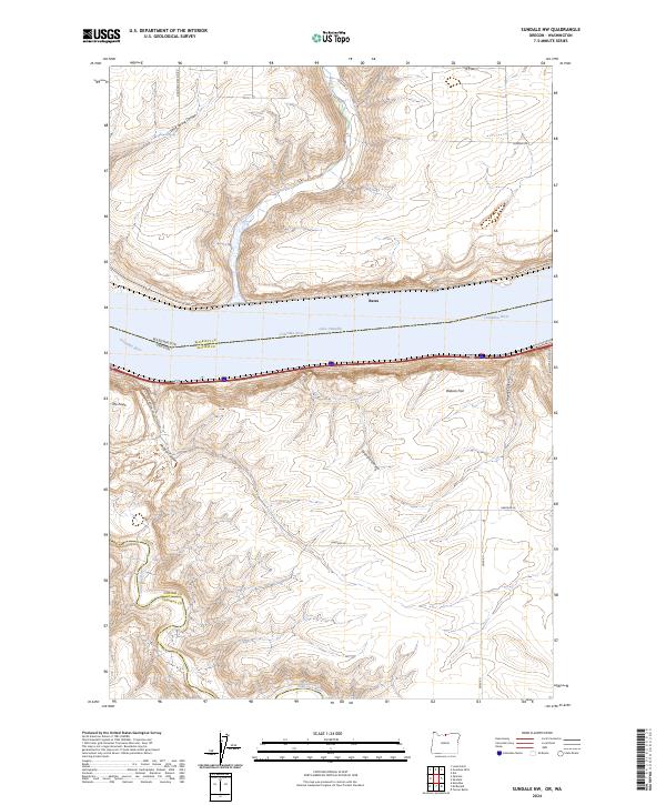
2024 Map of Sundale NW
USGS Topo · Published 2024About this map
The Columbia River and Lake Umatilla dominate the northern landscape of this region, where the state boundary separates Oregon from Washington. The terrain is defined by deep incisions like Sand Spring Canyon and Philippi Canyon, which carve through the high plateaus. Small settlements and local landmarks such as Bates and The Nook indicate the sparse but established human footprint in this river-driven economy. South of the main waterway, the John Day River winds through its designated John Day Wild and Scenic River corridor, showcasing a protected riparian environment. The mapping of Blalock Flat and numerous named canyons suggests a landscape where movement is dictated by the steep topography and the historical importance of water access. This modern survey captures the complex intersection of federal land management, state borders, and the natural drainage systems of Gilliam and Sherman Counties.
Find a feature on this map
25 named features on this map. Tap any name to fly to it.
Don’t see what you’re looking for? This feature index may not catch every label — zoom into the map to look around manually.
Map Details
Editions of this 2024 Sundale NW Map
This is the sole edition of this map. No revisions or reprints were ever made.
Other maps of this area

1916 · Arlington
USGS Topo · 1:125,000

1953 · The Dalles
USGS Topo · 1:250,000

1956 · The Dalles
USGS Topo · 1:250,000

1957 · The Dalles
USGS Topo · 1:250,000

1957 · Wasco
USGS Topo · 1:62,500

1957 · Satus Pass
USGS Topo · 1:62,500

1964 · Turner Butte
USGS Topo · 1:24,000

1964 · Mc Donald
USGS Topo · 1:24,000

1965 · Goodnoe Hills
USGS Topo · 1:24,000
1965 · Dot
USGS Topo · 1:24,000