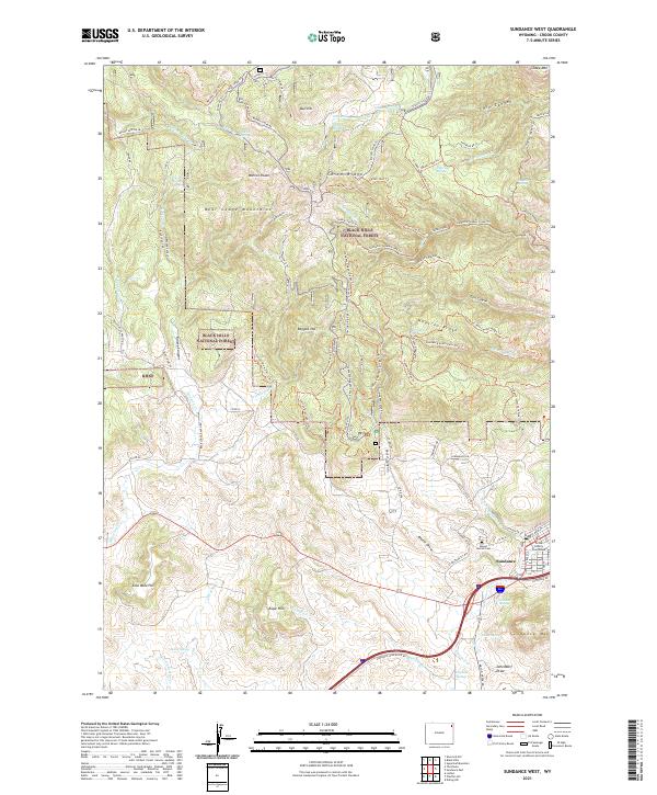
2021 Map of Sundance West
USGS Topo · Published 2021About this map
Sundance serves as the focal point for this survey, situated at the eastern edge of the Black Hills National Forest. The landscape is dominated by the dramatic uplift of the Bear Lodge Mountains, where Warren Peaks and Ragged Top create a complex topography of deep canyons and ridges. Near the town site, the Crook County Courthouse and Mount Moriah Cem provide significant landmarks for genealogical research, while the surrounding hills like Sundance Mtn and Coal Mine Hill indicate the area's geological and industrial history.
Find a feature on this map
104 named features on this map. Tap any name to fly to it.
Don’t see what you’re looking for? This feature index may not catch every label — zoom into the map to look around manually.
Map Details
Editions of this 2021 Sundance West Map
This is the sole edition of this map. No revisions or reprints were ever made.
Other maps of this area

1898 · Sundance
USGS Topo · 1:125,000

1901 · Aladdin
USGS Topo · 1:125,000

1902 · Sundance
USGS Topo · 1:125,000

1903 · Aladdin
USGS Topo · 1:125,000

1905 · Devils Tower
USGS Topo · 1:125,000

1918 · Moorcroft
USGS Topo · 1:125,000

1954 · Gillette
USGS Topo · 1:250,000

1955 · Devils Tower
USGS Topo · 1:62,500

1955 · Gillette
USGS Topo · 1:250,000

1957 · Nefsy Divide
USGS Topo · 1:62,500