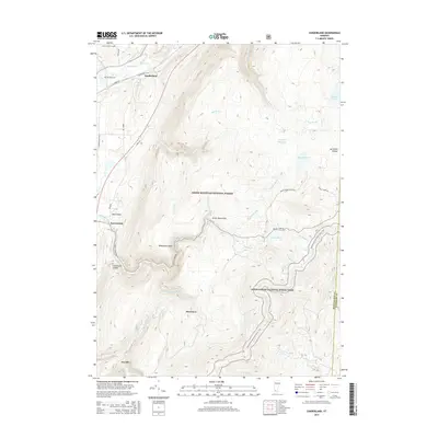
2015 Map of Sunderland
USGS Topo · Published 2015About this map
Sunderland and the surrounding high country of the Green Mountain National Forest define this 2015 survey of southern Vermont. The settlement pattern follows the valley of the Batten Kill and its many tributaries, while the eastern portion of the sheet is dominated by remote terrain and protected wilderness. Local history is anchored by sites like the Ira Allen Cem and Purdy Family Cem, which offer genealogical value for those tracing early families in the region. The Appalachian National Scenic Trail winds through the southern elevations, passing landmarks such as Whetstone Bluff and the waters of Lost Pond. The map also captures several high-elevation water bodies including Bourn Pond and Branch Pond, showing the dense network of brooks like Mill Brook and Roaring Br that drain the Green Mountains.
Find a feature on this map
42 named features on this map. Tap any name to fly to it.
Don’t see what you’re looking for? This feature index may not catch every label — zoom into the map to look around manually.
Map Details
Editions of this 2015 Sunderland Map
This is the sole edition of this map. No revisions or reprints were ever made.
Other maps of this area

1889 · Wilmington
USGS Topo · 1:62,500

1891 · Wilmington
USGS Topo · 1:62,500

1894 · Londonderry
USGS Topo · 1:62,500

1894 · Equinox
USGS Topo · 1:62,500

1896 · Equinox
USGS Topo · 1:62,500

1898 · Bennington
USGS Topo · 1:62,500

1899 · Londonderry
USGS Topo · 1:62,500

1899 · Wilmington
USGS Topo · 1:62,500

1900 · Taconic
USGS Topo · 1:125,000

1900 · Equinox
USGS Topo · 1:62,500