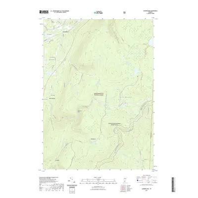
2021 Map of Sunderland
USGS Topo · Published 2021About this map
The Green Mountain National Forest dominates the landscape of this southern Vermont survey, where the peaks of the Green Mountains rise above the Batten Kill valley. This area preserves a network of historic pathways and water-driven geography, characterized by small settlements like Sunderland and East Kansas alongside remote outposts such as Fayville. The terrain is defined by dramatic elevations including Catamount Cobble, Whetstone Bluff, and MacIntyre, with drainage running through deep cuts like Lye Brook Hollow.
Find a feature on this map
59 named features on this map. Tap any name to fly to it.
Don’t see what you’re looking for? This feature index may not catch every label — zoom into the map to look around manually.
Map Details
Editions of this 2021 Sunderland Map
This is the sole edition of this map. No revisions or reprints were ever made.
Other maps of this area

1889 · Wilmington
USGS Topo · 1:62,500

1891 · Wilmington
USGS Topo · 1:62,500

1894 · Londonderry
USGS Topo · 1:62,500

1894 · Equinox
USGS Topo · 1:62,500

1896 · Equinox
USGS Topo · 1:62,500

1898 · Bennington
USGS Topo · 1:62,500

1899 · Londonderry
USGS Topo · 1:62,500

1899 · Wilmington
USGS Topo · 1:62,500

1900 · Taconic
USGS Topo · 1:125,000

1900 · Equinox
USGS Topo · 1:62,500