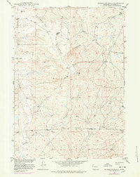
1949 Map of Sundquist Ranch
USGS Topo · Published 1978About this map
The high ranching country of Converse County is documented in this survey, showcasing the isolated operations and water management necessary for life on the Sundquist Flats. Centered on the Sundquist Ranch, the landscape is defined by the drainage systems of Lightning Creek to the north and Fetterman Creek to the south. Evidence of the region’s economic transition is visible through the oil interests and an underground Pipe Line that cuts across the southern sections, marking a shift from pure livestock ranching to energy extraction.
Find a feature on this map
15 named features on this map. Tap any name to fly to it.
Don’t see what you’re looking for? This feature index may not catch every label — zoom into the map to look around manually.
Map Details
Editions of this 1949 Sundquist Ranch Map
2 editions found
Other maps of this area

1949 · Sundquist Ranch
USGS Topo · 1:24,000

1949 · Orpha
USGS Topo · 1:24,000

1949 · Gilbert Lake
USGS Topo · 1:24,000

1949 · Douglas
USGS Topo · 1:24,000

1949 · Clausen Ranch
USGS Topo · 1:24,000

1949 · Antelope Creek
USGS Topo · 1:24,000

1950 · Clausen Ranch
USGS Topo · 1:24,000

1950 · Gilbert Lake
USGS Topo · 1:24,000

1950 · Douglas
USGS Topo · 1:24,000

1950 · Orpha
USGS Topo · 1:24,000