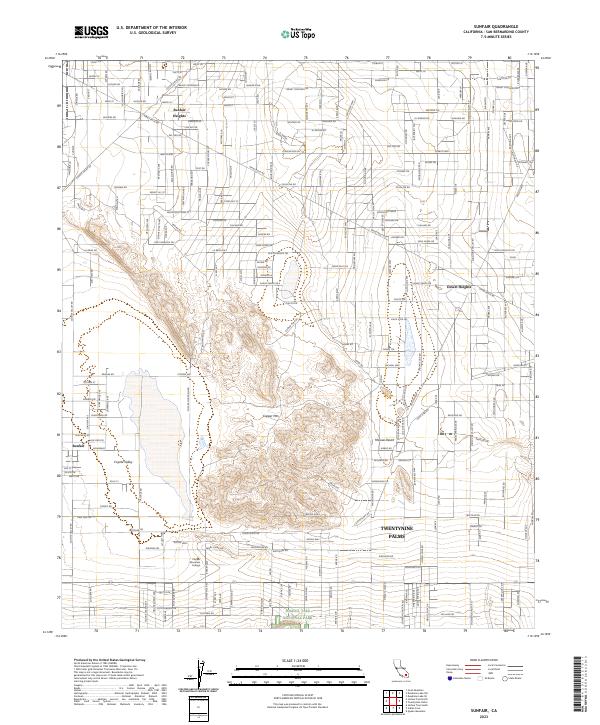
2023 Map of Sunfair
USGS Topo · Published 2023About this map
Copper Mtn dominates the central landscape of this desert corridor, standing between the residential developments of Sunfair and the growing northern edge of Twentynine Palms. The map illustrates a distinctive high-desert settlement pattern where named crossroads like Brant Crossroad and Labram Xing anchor a grid of planetary-named streets such as Pluto St and Saturn Rd. This 2023 survey provides a detailed view of the transition from rural desert tracts to protected lands, with the southern boundary reaching into Joshua Tree National Park. Educational infrastructure is represented by the campus of Copper Mountain College, while topographic features like Moonlight Mesa and the expansive Coyote Valley define the region's physical character. The survey also identifies smaller residential pockets such as Sunfair Heights and Desert Heights, reflecting the ongoing habitation of the Mojave Desert fringe.
Find a feature on this map
165 named features on this map. Tap any name to fly to it.
Don’t see what you’re looking for? This feature index may not catch every label — zoom into the map to look around manually.
Map Details
Editions of this 2023 Sunfair Map
This is the sole edition of this map. No revisions or reprints were ever made.
Other maps of this area

1953 · San Bernardino
USGS Topo · 1:250,000

1955 · Goat Mountain
USGS Topo · 1:24,000

1955 · Deadman Lake SE
USGS Topo · 1:24,000

1955 · Deadman Lake SW
USGS Topo · 1:24,000

1955 · Twentynine Palms
USGS Topo · 1:24,000

1955 · Twentynine Palms
USGS Topo · 1:62,500

1955 · Emerson Lake
USGS Topo · 1:62,500
1955 · Deadman Lake
USGS Topo · 1:62,500

1955 · Joshua Tree
USGS Topo · 1:62,500

1956 · San Bernardino
USGS Topo · 1:250,000