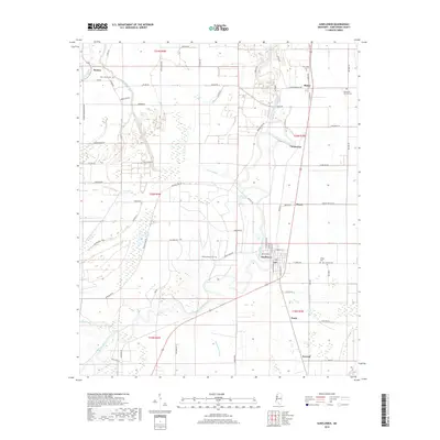
2018 Map of Sunflower
USGS Topo · Published 2018About this map
The Big Sunflower River defines the landscape of this Sunflower County region, winding through a complex network of bayous and wetlands in the heart of the Mississippi Delta. Small agricultural settlements like Sunflower, Blaine, and Steiner are connected by a grid of rural roads, including Blaine Rd and Sunflower Rd. This modern survey illustrates the persistent importance of local burial grounds for genealogical research, documenting several named sites such as Saint James Cem, New Hope Cem, and Willing Worker Cem. The topography is marked by distinctive natural features like Turkeyfoot Brake and Roundaway Bayou, alongside family-named landmarks such as Gorman Lake and James Bayou. The map reveals the layout of the Delta's township and range system, showing how the land is partitioned into sections for agriculture and resource management.
Find a feature on this map
70 named features on this map. Tap any name to fly to it.
Don’t see what you’re looking for? This feature index may not catch every label — zoom into the map to look around manually.
Map Details
Editions of this 2018 Sunflower Map
This is the sole edition of this map. No revisions or reprints were ever made.
Other maps of this area

1931 · Schlater
USGS Topo · 1:48,000

1934 · Cleveland
USGS Topo · 1:62,500

1934 · Schlater
USGS Topo · 1:62,500

1939 · Schlater
USGS Topo · 1:62,500

1940 · Baird
USGS Topo · 1:62,500

1940 · Cleveland
USGS Topo · 1:62,500

1953 · Greenwood
USGS Topo · 1:250,000

1956 · Greenwood
USGS Topo · 1:250,000

1961 · Mossy Lake
USGS Topo · 1:62,500
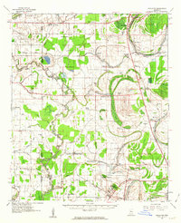
1961 · Schlater
USGS Topo · 1:62,500