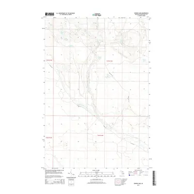
2014 Map of Sunken Lake
USGS Topo · Published 2014About this map
Sunken Lake sits at the heart of this remote Upper Peninsula landscape, where a dense network of water bodies and tributary streams defines the terrain within the Seney Township region. The hydrology is dominated by the Fox River and the West Br Fox River, which snake through low-lying marshlands and glacial depressions. This 2014 survey reveals an area largely untouched by dense settlement, characterized instead by named ponds and unique aquatic features like Section Seven Lake, Sucker Lake, and the small Duck Hole Lake.
Find a feature on this map
20 named features on this map. Tap any name to fly to it.
Don’t see what you’re looking for? This feature index may not catch every label — zoom into the map to look around manually.
Map Details
Editions of this 2014 Sunken Lake Map
This is the sole edition of this map. No revisions or reprints were ever made.
Other maps of this area

1931 · Seney SW
USGS Topo · 1:31,680

1931 · Seney NW
USGS Topo · 1:31,680

1931 · Driggs Lake NE
USGS Topo · 1:31,680

1931 · Driggs Lake NW
USGS Topo · 1:31,680

1931 · Driggs Lake SW
USGS Topo · 1:31,680

1931 · Driggs Lake SE
USGS Topo · 1:31,680

1954 · Sault Sainte Marie
USGS Topo · 1:250,000

1956 · Sault Sainte Marie
USGS Topo · 1:250,000

1957 · Sault Sainte Marie
USGS Topo · 1:250,000

1958 · Sault Sainte Marie
USGS Topo · 1:250,000