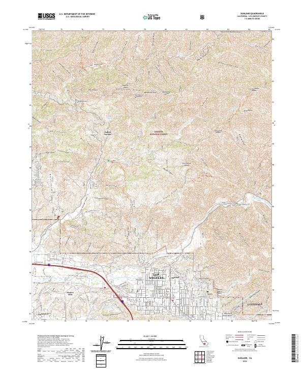
2022 Map of Sunland
USGS Topo · Published 2022About this map
Sunland and the Crescenta Valley are shown here where the dense suburban grid of northern Los Angeles meets the steep slopes of the San Gabriel Mountains. The landscape is defined by the tension between development and nature, illustrated by the complex network of flood control infrastructure such as the Haines Debris Basin and numerous channels like the Haines Canyon Channel. To the south, the Verdugo Mountains rise above neighborhoods like Shadow Hills and Stonehurst, while the northern portion of the map is dominated by the Angeles National Forest. Here, a series of ridges and saddles, including Mendenhall Ridge and Gold Creek Saddle, are accessed by fire roads and trails like the Ebey Herreres Truck Trl. Genealogists and local historians will find the exact locations of Glen Haven and Sholom Memorial Park and the Verdugo Hills Cem clearly marked among the residential streets.
Find a feature on this map
145 named features on this map. Tap any name to fly to it.
Don’t see what you’re looking for? This feature index may not catch every label — zoom into the map to look around manually.
Map Details
Editions of this 2022 Sunland Map
This is the sole edition of this map. No revisions or reprints were ever made.
Other maps of this area

1894 · Los Angeles
USGS Topo · 1:62,500

1896 · Pasadena
USGS Topo · 1:62,500

1896 · Santa Monica
USGS Topo · 1:62,500

1898 · Santa Monica
USGS Topo · 1:62,500

1900 · Pasadena
USGS Topo · 1:62,500

1900 · Tujunga
USGS Topo · 1:62,500

1900 · Los Angeles
USGS Topo · 1:62,500

1900 · Fernando
USGS Topo · 1:62,500

1901 · Southern California Sheet No. 1
USGS Topo · 1:250,000

1902 · Santa Monica
USGS Topo · 1:62,500