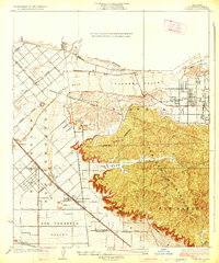
1926 Map of Sunland
USGS Topo · Published 1926About this map
Tujunga Valley and the northern reaches of the San Fernando Valley define this mid-1920s landscape, illustrating a period of transition before the heavy suburbanization of the region. The map captures a largely open terrain where early infrastructure like the Edison Power Line and the Southern Pacific San Fernando Line cut across the alluvial plains of the Tujunga Wash. Settlement centers are concentrated at Sunland, Roscoe, and Hewitt, showing the early grid layouts and road networks such as Lankershim Boulevard and Sherman Way.
Find a feature on this map
21 named features on this map. Tap any name to fly to it.
Don’t see what you’re looking for? This feature index may not catch every label — zoom into the map to look around manually.
Map Details
Editions of this 1926 Sunland Map
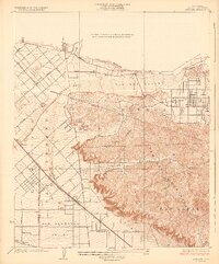
2 editions found
Other maps of this area

1894 · Los Angeles
USGS Topo · 1:62,500

1896 · Santa Monica
USGS Topo · 1:62,500

1898 · Santa Monica
USGS Topo · 1:62,500

1900 · Los Angeles
USGS Topo · 1:62,500

1900 · Fernando
USGS Topo · 1:62,500

1901 · Southern California Sheet No. 1
USGS Topo · 1:250,000

1902 · Santa Monica
USGS Topo · 1:62,500

1904 · Southern California Sheet No. 1
USGS Topo · 1:250,000

1920 · Santa Monica
USGS Topo · 1:62,500
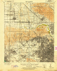
1921 · Santa Monica
USGS Topo · 1:62,500