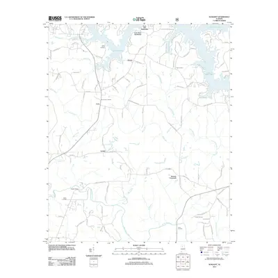
2011 Map of Sunlight
USGS Topo · Published 2011About this map
Lewis Smith Lake dominates the northern landscape of this Walker County region, where intricate fingers of the reservoir reach into the surrounding forest. The area's settlement pattern is defined by rural crossroads and growing residential pockets like the Lone Oak Subdivision and Lake Shore Subdivision. Central to the map's geography is the eponymous community of Sunlight, situated south of Marylee and Curry. The terrain is deeply etched by a network of waterways including Mill Creek, Blackwater Creek, and Rock Creek, which dictate the winding paths of local roads such as Old Duncan Bridge Rd and Smith Lake Dam Rd.
Find a feature on this map
103 named features on this map. Tap any name to fly to it.
Don’t see what you’re looking for? This feature index may not catch every label — zoom into the map to look around manually.
Map Details
Editions of this 2011 Sunlight Map
This is the sole edition of this map. No revisions or reprints were ever made.
Other maps of this area

1893 · Jasper
USGS Topo · 1:125,000

1949 · Cordova
USGS Topo · 1:24,000

1949 · Sipsey
USGS Topo · 1:24,000

1949 · Cold Springs
USGS Topo · 1:24,000

1949 · Jasper
USGS Topo · 1:24,000

1949 · Manchester
USGS Topo · 1:24,000

1949 · Sunlight
USGS Topo · 1:24,000

1950 · Manchester
USGS Topo · 1:24,000

1951 · Jasper
USGS Topo · 1:24,000

1951 · Cold Springs
USGS Topo · 1:24,000