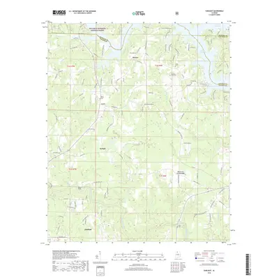
2018 Map of Sunlight
USGS Topo · Published 2018About this map
Lewis Smith Lake dominates the northeastern corner of this area north of Jasper, where the waters of the Sipsey Fork and surrounding creeks meet at the boundaries of Winston, Walker, and Cullman counties. The landscape transitions from the protected timberlands of the William B. Bankhead National Forest in the northwest to a network of rural communities including Marylee, Curry, and Sunlight. Family and community history is anchored by numerous small burial grounds such as Tingle Cem, Blooming Grove Cem, and Tidwell Cem, which are scattered throughout the hilly terrain. The map traces the winding course of Blackwater Creek and its tributaries like Little Blackwater Cr, crossing the landscape at landmarks such as Walston Bridge. This 2018 survey provides a detailed view of the contemporary road network and residential subdivisions that have developed along the shoreline of the lake.
Find a feature on this map
108 named features on this map. Tap any name to fly to it.
Don’t see what you’re looking for? This feature index may not catch every label — zoom into the map to look around manually.
Map Details
Editions of this 2018 Sunlight Map
This is the sole edition of this map. No revisions or reprints were ever made.
Other maps of this area

1893 · Jasper
USGS Topo · 1:125,000

1949 · Cordova
USGS Topo · 1:24,000

1949 · Sipsey
USGS Topo · 1:24,000

1949 · Cold Springs
USGS Topo · 1:24,000

1949 · Jasper
USGS Topo · 1:24,000

1949 · Manchester
USGS Topo · 1:24,000

1949 · Sunlight
USGS Topo · 1:24,000

1950 · Manchester
USGS Topo · 1:24,000

1951 · Jasper
USGS Topo · 1:24,000

1951 · Cold Springs
USGS Topo · 1:24,000