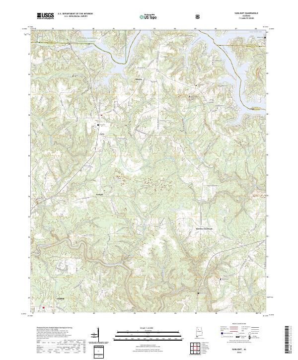
2024 Map of Sunlight
USGS Topo · Published 2024About this map
William B. Bankhead National Forest defines the northern edge of this landscape, where the wooded hills of the Cumberland Plateau meet the deep inlets of Lewis Smith Lake. The map reveals a dense network of country roads connecting small communities such as Marylee, Curry, and Sunlight, as well as the junction at Burrows Crossroads. These settlements are characterized by numerous small cemeteries, including Tingle Cem, Blooming Grove Cem, and Wilson Cem, which provide significant points of interest for genealogical research in this part of Walker and Cullman Counties.
Find a feature on this map
121 named features on this map. Tap any name to fly to it.
Don’t see what you’re looking for? This feature index may not catch every label — zoom into the map to look around manually.
Map Details
Editions of this 2024 Sunlight Map
This is the sole edition of this map. No revisions or reprints were ever made.
Other maps of this area

1893 · Jasper
USGS Topo · 1:125,000

1949 · Cordova
USGS Topo · 1:24,000

1949 · Sipsey
USGS Topo · 1:24,000

1949 · Cold Springs
USGS Topo · 1:24,000

1949 · Jasper
USGS Topo · 1:24,000

1949 · Manchester
USGS Topo · 1:24,000

1949 · Sunlight
USGS Topo · 1:24,000

1950 · Manchester
USGS Topo · 1:24,000

1951 · Jasper
USGS Topo · 1:24,000

1951 · Cold Springs
USGS Topo · 1:24,000