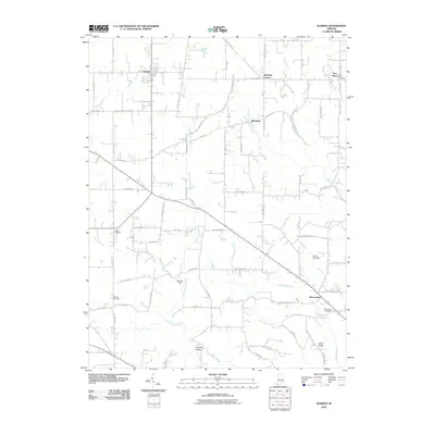
2010 Map of Sunman
USGS Topo · Published 2010About this map
North Hogan Creek and its many tributaries, including Butternut Run and Little Hogan Creek, carve through this section of Ripley County. The landscape is defined by a network of rural settlements connected by a grid of county roads, with Sunman and Manchester serving as primary hubs. Local history is anchored by several burial grounds, including the Franklin Cemetery and Ransom Cemetery, which offer valuable points of reference for genealogists. The topography is marked by distinct features such as Round Hill and Johnson Hollow, illustrating the varied elevation of the Indiana countryside. Smaller communities like Weisburg, New Alsace, and Hubbells Corner dot the map, while Perrine Lake Dam represents 21st-century water management in the region. This 2010 survey reflects the enduring rural character of the area, where established family names are often preserved in the labeling of landmarks and roads.
Find a feature on this map
76 named features on this map. Tap any name to fly to it.
Don’t see what you’re looking for? This feature index may not catch every label — zoom into the map to look around manually.
Map Details
Editions of this 2010 Sunman Map
This is the sole edition of this map. No revisions or reprints were ever made.
Other maps of this area

1915 · Lawrenceburg
USGS Topo · 1:48,000

1915 · Harrison
USGS Topo · 1:48,000

1928 · Lawrenceburg
USGS Topo · 1:62,500

1932 · Lawrenceburg
USGS Topo · 1:62,500

1943 · Aurora
USGS Topo · 1:24,000

1943 · Guilford
USGS Topo · 1:24,000

1946 · Milan
USGS Topo · 1:24,000

1946 · Pierceville
USGS Topo · 1:24,000

1946 · Batesville
USGS Topo · 1:24,000

1953 · Aurora
USGS Topo · 1:24,000