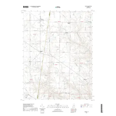
2019 Map of Sunman
USGS Topo · Published 2019About this map
Sunman and the surrounding rural landscape across the Ripley and Dearborn County line are defined by a complex network of waterways and elevated ridges. The terrain transitions from the headwaters of Ripley Creek in the west to the dissected plateaus of Ester Ridge and Holman Ridge in the east. Small crossroad settlements like Hubbells Corner, Negangards Corner, and Weisburg anchor the agricultural landscape, while the town of Milan sits at the southwestern edge of the survey.
Find a feature on this map
118 named features on this map. Tap any name to fly to it.
Don’t see what you’re looking for? This feature index may not catch every label — zoom into the map to look around manually.
Map Details
Editions of this 2019 Sunman Map
This is the sole edition of this map. No revisions or reprints were ever made.
Other maps of this area

1915 · Lawrenceburg
USGS Topo · 1:48,000

1915 · Harrison
USGS Topo · 1:48,000

1928 · Lawrenceburg
USGS Topo · 1:62,500

1932 · Lawrenceburg
USGS Topo · 1:62,500

1943 · Aurora
USGS Topo · 1:24,000

1943 · Guilford
USGS Topo · 1:24,000

1946 · Milan
USGS Topo · 1:24,000

1946 · Pierceville
USGS Topo · 1:24,000

1946 · Batesville
USGS Topo · 1:24,000

1953 · Aurora
USGS Topo · 1:24,000