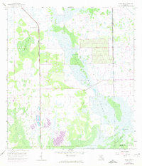
1958 Map of Sunniland
USGS Topo · Published 1973About this map
The Seaboard Coast Line railroad cuts a straight north-south path through the center of this 1958 survey, marking a corridor of industry in the Florida Everglades. Near the settlement of Sunniland, numerous Oil Well sites dot the landscape, reflecting the region's mid-century petroleum development. The natural environment is dominated by vast wetlands, including the Okaloacoochee Slough and Sunniland Swamp, where traditional landmarks like Owl Hammock and Sick Island rise above the water levels.
Find a feature on this map
17 named features on this map. Tap any name to fly to it.
Don’t see what you’re looking for? This feature index may not catch every label — zoom into the map to look around manually.
Map Details
Editions of this 1958 Sunniland Map
3 editions found
Other maps of this area

1956 · West Palm Beach
USGS Topo · 1:250,000

1957 · West Palm Beach
USGS Topo · 1:250,000

1958 · West Palm Beach
USGS Topo · 1:250,000

1958 · Catherine Island
USGS Topo · 1:24,000

1958 · Immokalee
USGS Topo · 1:24,000

1958 · Sunniland
USGS Topo · 1:24,000

1958 · Immokalee NE
USGS Topo · 1:24,000

1958 · Immokalee SW
USGS Topo · 1:24,000

1959 · Miles City
USGS Topo · 1:24,000
1962 · Catherine Island
USGS Topo · 1:24,000